 Videos
 Photos


International Adventurers CommenceMarking First Trans-Armenian Trail
How does one develop hiking in Armenia? It’s a question a lot of people are asking lately and everyone appears to have a different answer. Some prefer a top-down approach; finding major investments, pioneering infrastructure, and playing the necessary waiting game involved for these things to develop… Certainly, Armenia needs all of this. But just as valuable as the top-down initiatives are grassroots ones, where adventurous individuals get the ball rolling from the bottom-up.
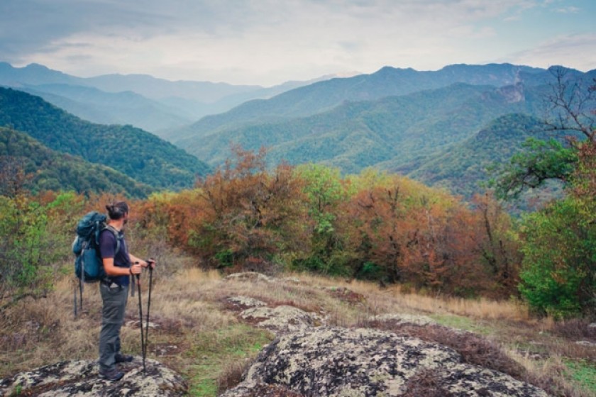
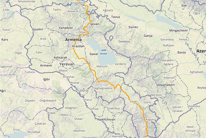
Such is the case with the Trans-Armenian Trail (TAT), a long-term project founded by four individuals from four countries, who have come together in Armenia with the ambitious goal of developing the country’s first long-distance hiking trail. The trail will span 1,000km, reaching from Bagratashen, a town on the northern border of Armenia, to Meghri, a town on the southern border with Iran.
TAT is the sister-organization a larger effort to building a world-class, long-distance hiking trail - the Transcaucasian Trail (TCT) - across the Caucasus, linking roughly two dozen existing and proposed national parks in the region. The reason for collaborating with TCT, say organizers, is to increase the sustainability and feasibility of the program. “Armenia is in the Caucasus, a hikers paradise. This trail will help put Armenia on the world hiking map and connect it to trails in neighboring countries, so it makes sense that we would involve those countries in a more large scale plan.”
While the TAT is a group effort, the idea has its origins in the adventurous musings of Tom Allen, British writer, blogger, and filmmaker who left his comfortable job as a web developer in 2006 to journey across more than 50 countries on foot, by bicycle, kayak and on horseback. In 2013, Allen and his Iranian-Armenian wife made Armenia their permanent home and since then, he has dedicated the next few years of his career to this cause.
The rest of the team includes Alessandro Mambelli, an Italian engineer, tech entrepreneur and self-proclaimed ‘professional nomad’, VahagnVardumyan, a cycling activist, eco-tourism specialist, and former radio-journalist, andRaffi Kojian, an Ethiopian-American-Armenian responsible for some of Armenia’s shining achievements in modern tourism, such as the nation's first Tourist Information Office, the first post-Soviet guidebook, and the extensive Armeniapedia.org, and is responsible for the Janapar Trail, a two-week-long hiking trail across Karabakh.
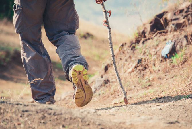
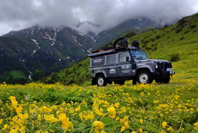
Combined, the three have already covered much ground towards making the TAT a reality. While the entire project is much larger in scope, the scouting portion began in mid April of 2016, thanks to a generous grant from the The Land Rover Bursary, which included the use of an off-road vehicle (a Land Rover Defender) and a working budget to cover expedition costs and equipment, which ultimately means we can spend the whole summer actually exploring Armenia's wildernesses and gather digital data for later publishing.
This last part is critical, Allen notes, as “Armenia’s best topographical maps – crucial in a place so mountainous – remain the Cold War-era maps made by the Soviet military. Publicly-available aerial photography is dated and in many places too low in resolution to be useful.” This dearth of information, he adds, makes it extremely difficult for even reasonably experienced travellers to get around the region.
The team ultimately hopes that the TAT will be valuable in securing a steady flow of adventure travelers to the region in the near future and is excited to pioneer a trail that will be a totally new type of experience for hikers in the famously mountainous Caucasus region. The scouting portion of the project is being documented and recorded by Allen and Mambelli under the name The Transcaucasian Expedition and you can follow along on their journey on their Facebook page. They expect to have 1,500km of trail marked with GPS coordinates by the end of the 2016 hiking season. Currently, the seeking local partners located in the regions who are interested in developing and maintaining sections of the trail as part of a concerted move towards hiking trail development in Armenia. If you are interested in getting involved, please visit us at www.transcaucasiantrail.com.
Write a comment